


Description
HiPer VR GNSS
The HiPer VR is a complete solution and versatile in many ways. It can be used for static or kinematic GNSS post-processed surveys, as a network RTK rover with the FC-6000’s internal 4G/LTE cellular modem, as a UHF/FH/Longlink job site RTK rover, and also in Topcon’s patented Hybrid Positioning workflow.
Get all satellites, and all constellations – in a compact, rugged design (GPS, GLONASS, Galileo, BDS, QZSS, SBAS, IRNSS)
Built lightweight but with strong aluminum alloy housing, the VR can take the punishment of a job site. No weak plastic units here. And, the unit is IP67 waterproof.
Topcon Tilt
Measure building edges without using an offset, or stretch to otherwise out-of-reach points using Topcon Integrated Leveling Technology (TILT). A 9-axis inertial measurement unit (IMU) paired with a digital compass allows the HiPer receivers to compensate for rods that are not exactly vertical. Topcon Tilt Technology compensates the receiver up to 15 degrees of tilt and leads the market with the best tilt accuracy available.
A simple calibration routine and a button click, and you are off and running using Tilt. A digital level bubble appears on your screen and shows you the degree of tilt and if you are within specs.
PPP – Starpoint & Skybridge
Available PPP through Topcon’s Starpoint and SkyBridge. Take your RTK to the next level. By enabling Starpoint on your HiPer VR you can get 2-5 cm corrections without a base and without cellular connection anywhere in the world. Enabling Starpoint on your HiPer VR you can extend RTK corrections past the limit of your RTK network or local base station.
HiPer receivers are a popular choice for survey applications, including property boundaries, engineering design, and cadastral projects. These versatile tools are also often used for construction site layout/stakeout, grade checking, and material volume calculations. HiPer receivers can also be paired with robotic total stations for Hybrid Positioning™.
Universal Tracking Channels™ technology
Topcon-patented Universal Tracking Channels technology efficiently identifies and uses “all in view” GNSS satellite constellations and signals – automatically optimizing reception. This means Topcon receivers do not need 600-800 channels to track 40+ satellites. With only 226 universal channels, the VR tracks everything our competitors do.
Hybrid Positioning
Hybrid Positioning™ technology combines GNSS (sometimes called GPS) positioning and optical robotic measurements on one rover pole. Finish projects quickly and accurately by easily switching between prism- and satellite-based measurement modes when you lose line-of-sight or satellite reception, or as you encounter other job site challenges.
Hybrid systems perform faster in the field than stand-alone robotic systems and are more versatile than RTK-only solutions. Our Hybrid Positioning technology combines GNSS positioning and optical robotic measurements on one rover pole.
Topcon Hybrid Positioning system has a lightweight HiPer VR receiver on the prism, which enables the system to reacquire targets even in challenging conditions. Setups are a snap. You can select safe, convenient locations and define the unknown point of your instrument from GNSS measurements.
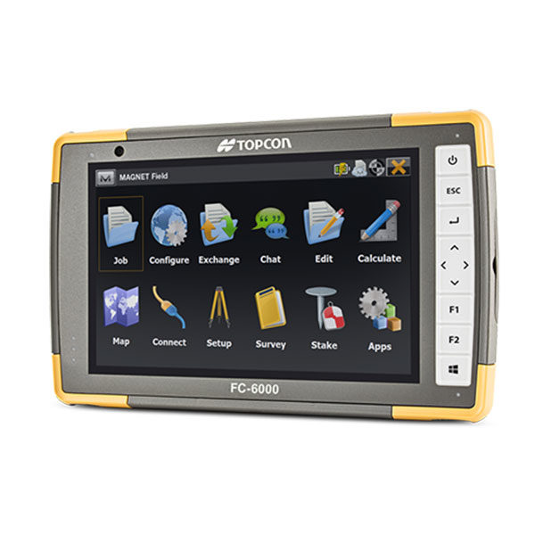
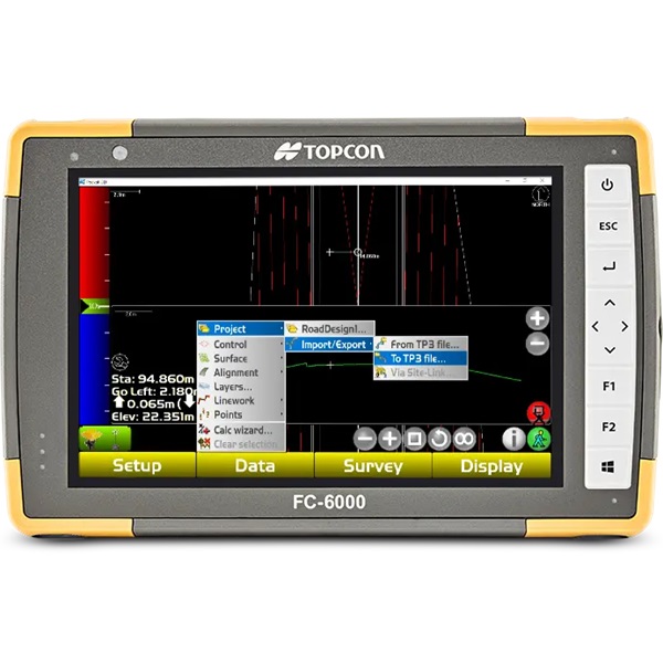
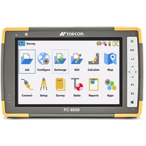
For maximum efficiency, pair our Hybrid Positioning technology with MAGNET Field data-collection software.
Top features include:
- Universal tracking technology for all satellites and constellations
- High-accuracy TILT with 9-axis IMU and ultra-compact 3-axis eCompass
- Field-tested, field-ready IP67 design
- Compact form factor ideal for Millimeter GPS and Hybrid Positioning
- Ready to work with Topcon’s Magnet Field and Pocket 3D Software
- Choice of 450-470 MHz UHF Radio or License-free 915 MHz Radio Modem
- Integrated LongLink Bluetooth Radio
- PPP enabled (with subscription) for RTK anywhere