Description
Pix4D ULTIMATE AEC HARDWARE BUNDLE
Software solutions for processing, vectorizing, and sharing. The only drone mapping & photogrammetry software tools with a flight app, desktop, and cloud platforms.
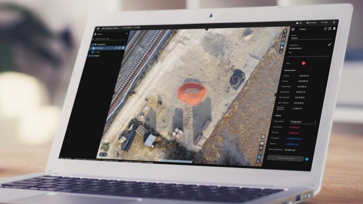
PIX4Dmatic
Matic Next-generation photogrammetry software for professional drone and terrestrial mapping
This Next-generation photogrammetry software for professional drone and terrestrial mapping can processes thousands of images while maintaining survey-grade accuracy, halving the processing time, without the trouble of splitting and merging. Developed in close collaboration with surveyors and mapping professionals to streamline your workflow: import, process and assess the quality of a project in just a few clicks, and move seamlessly from PIX4Dmatic to PIX4Dsurvey. Leverage the benefits of both photogrammetry and LiDAR technology. Process LiDAR and RGB image outputs from PIX4Dcatch for a full terrestrial workflow. Easy and desktop-based.
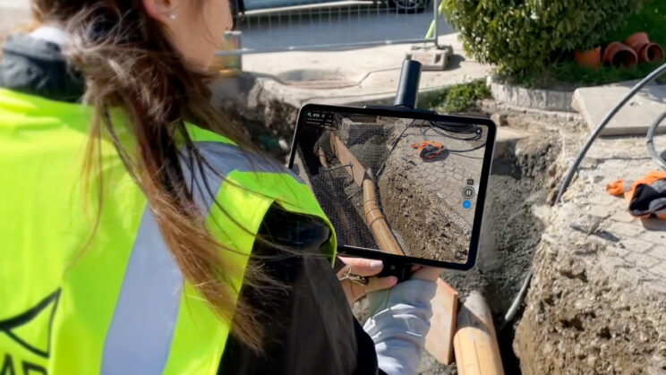
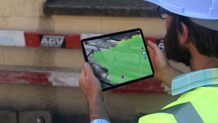
Pix4Dcatch
PIX4Dcatch is a mobile application designed for iOS and Android devices that enables you to take images of a scene, ready to be converted into a 3D model geolocated and in real-time. From underground utilities to forensics, create a model of your scanned objects for use in different industries. Create geolocalized open trench models by simply walking around them. Accurately document and calculate volumes for invoicing. Quickly and accurately collect, process, and visualize as-built measurements and 3D models, even in the most demanding conditions. Complete an entire survey in a few minutes and create a 3D point cloud, a digital surface model, and a true orthomosaic of your area. Efficiently build accurate 3D collision scenes, add detailed measurements, and share insights with major forensic software platforms.
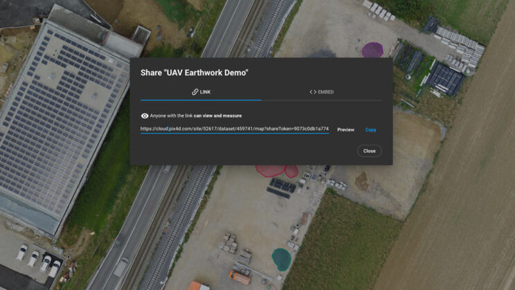
Pix4Dcloud
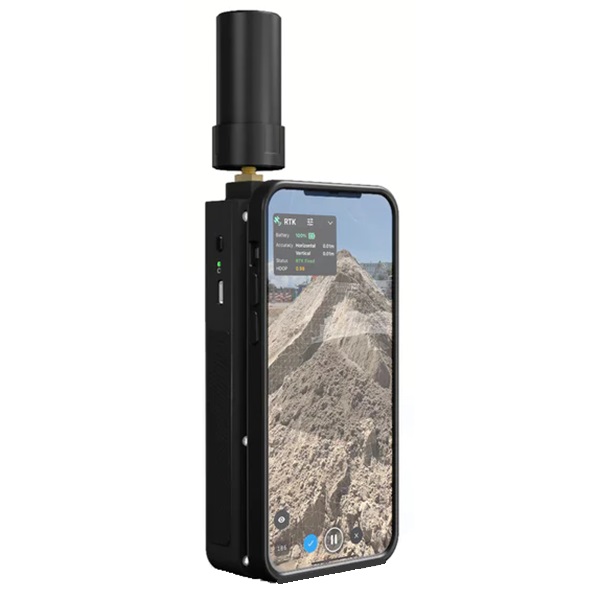
The online platform for ground and drone mapping, progress tracking, and site documentation. Collect terrestrial data using PIX4Dcatch and viDoc RTK rover and get measurements at centimeter-level absolute accuracy. Start your new project in minutes. User-friendly platform with no previous training required. Share your project status with the team and stakeholders with the click of a button. Keep a permanent and up-to-date record of the project and resolve disputes efficiently.
Pix4DSurvey
Bridge the gap between photogrammetry and CAD. Capture images or point clouds with a drone or any laser scanner. Use the combined power of images and point clouds to extract key elements from photogrammetry, laser scanning, or LiDAR data. Survey curbs, building footprints, walls, catenary curves, and more. Work 50% faster when you vectorize from point clouds and verify in images, while the Smart Grid saves 1,000s of clicks creating spot elevations. Include layers and properties for a smooth transition to CAD or GIS and reduce file size when exporting your projects as vector files. Create and measure the volume of any object, even against a wall or in a corner, with fast, simple steps.
Automate the creation of spot elevations and allow drastic simplification of the number of point cloud points. With a click, use this Grid of points to model the ground with a TIN.
Extract the same points you would use in the field with Smart Grid – it doesn’t create any data, but instead reads the terrain class for locations of elevation change, just like your field crew would take spot elevations along break lines.
Next up? Take that set of points & break lines and create a DTM in LandXML format that exactly reflects the points you have told it to use. Now you are good to go in your CAD or GIS!
Features
- Fast and accurate as-builts – don’t wait for a survey crew
- Easy to use with minimal training
- Measure stockpiles and get near real-time volumes
- Fast access to data for remote construction inspection
- Safer 3D scans and as-built data – no climbing piles or entering pits to collect data
- Supports all coordinate systems, including local, for importing ground control points (GCPs)
- 3D Accident Reconstruction
- Secure chain of custody for data
- Compact scanning system for small areas