The fastest, easiest, and most affordable way to map & reconstruct your scene.
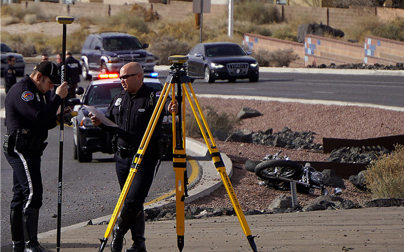
Accident investigations - Crime scene investigations - Fire & exposion
Capture every detail of the scene you need quickly and safely with the easiest field software available. Our customizable field software only takes a day or two to learn and not weeks or months. GeoShack offers a variety of hardware solutions that allow your team to map whatever your budget range. Whether you need basic sketches, complete scene mapping, or point clouds for an immersive 3D experience, we have the solutions that will give you the tools you need to clear scenes at record speeds. Our hardware and software solutions work with most of the current office software you already have. Call today to get a virtual or hands-on demonstration
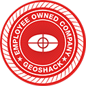
PIX4D viDoc
Our viDoc with PIX4D allows you to efficiently build accurate 3D collision scenes, add detailed measurements, and share insights with major forensic software platforms. The viDoc is your hand-held incident scanner, turning your mobile device into a professional 3D scanner. You collect GCP data and single point measurements for a fraction of the cost, on-site quickly with a mobile scan. With the viDoc you get fast deployment and processing results in-field. The PIX4D real-time 3D model application ensures complete data collection. Scan, import, process and upload and assess the quality of an incident in just a few clicks. Now you can easily create high quality 3D scans that are geospatially accurate and easy to share.
Hybrid Mapper
Hybrid Positioning combines GNSS and Total Station technologies for maximum versatility
• GNSS satellite positioning – map without needing line of sight • Robotic systems measure to places GNSS can’t always go • Reduce time and set up by using all types of measurements • Measure reflectorless to map points on objects or crush zones on vehicles
GNSS Mapper
Collect data without the need to sight it from a land-based instrument.
• Large sites are no problem with only one set up and one person • No need of line of sight • Fast and simple set up – the fastest and easiest way to measure • Use a base & rover unit or rover only if in a “network” area
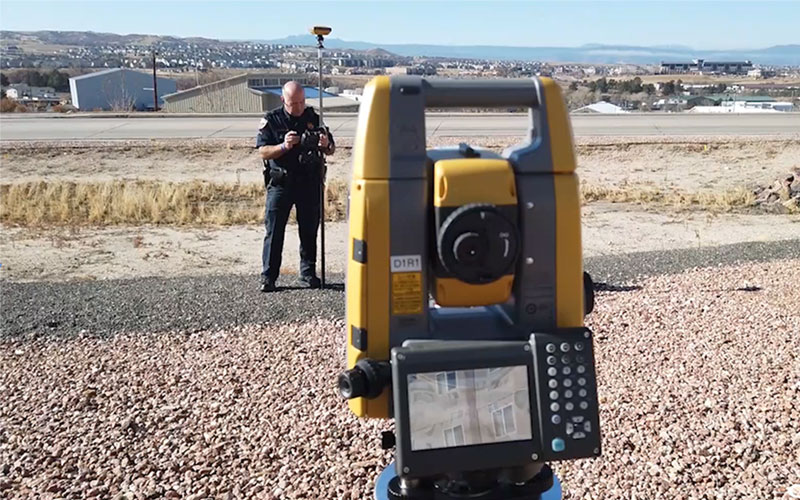
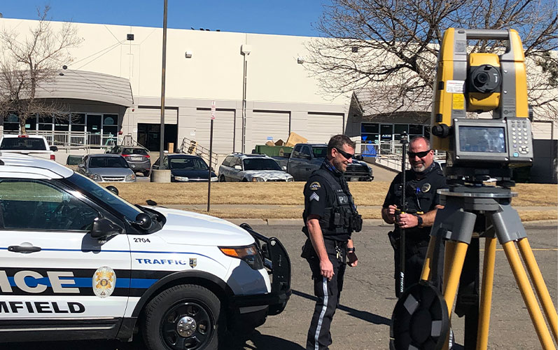
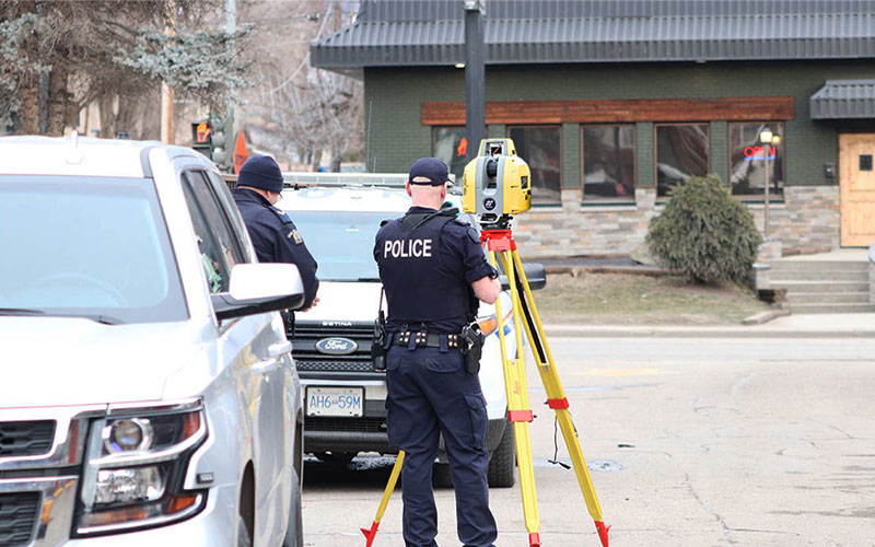
Robotic Mapper
One person can operate the Topcon GT robotic total station and collect data.
• This is our most popular system • Collect data at the prism & controller-no sighting through the scope • Allows one person to map the scene from the pole for fewer mistakes • Measure reflectorless to map points on objects or crush zones on vehicle
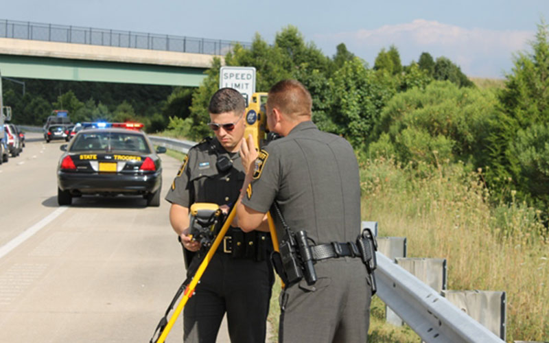
Economy Mapper
The lowest cost system we offer.
• A conventional total station and field controller help you map the scene • Two-person system: one person at the unit and the other at the pole • Measure reflectorless to map points on objects or crush zones on vehicles • Most economical system for small departments and start-ups
Laser Scanner
Get every detail quickly and accurately with the GLS-2200
• Use it stand alone, or set it up on control points to map everything • No need to worry about aligning your scans again or using targets • Export into many different file formats • Use Magnet Collage to color the point cloud of your scene • Fast scans that take from 3-10 minutes each
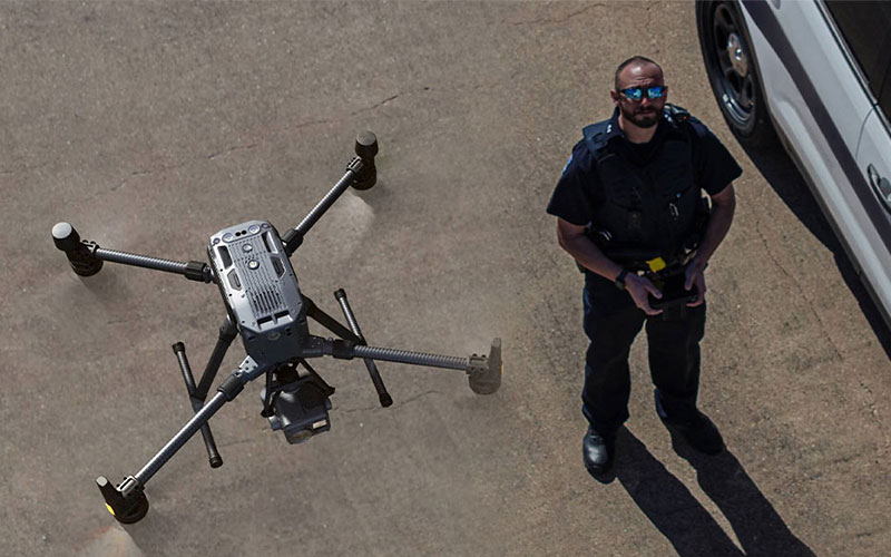
UAV Solutions
Call us so we can help customize your UAV solutions with the leading experts in the business
• Multiple manufacturers to choose from • Photo, video, lidar, and thermal sensors available • Customizable packages starting under $3000 • Complete training and support from Drone expert
Request More Info/Demo
We can’t wait to show you what we can do for your business. Request your demo today.